


| Sugarloaf Sailing Club |
| Weather |


|
|
|||
|
|
||
|
| |||
 Storm? Storm?
|
Park Status? |
 Fire? Fire?
|
|
Current Observation (Coldstream 74m AHD) No Sailing Today, 31/7/2026
Forecasts (Blockhouse Mark 172m AHD) Short Range Forecast utc=2026-08-02T04:00:00Z
local=2026-08-02 14:00:00 dst=0
Long Range Forecast utc=2026-09-06T06:00:00Z
* HE = Approximate Average Hiking Effort for the class recommended crew weight, close hauled. - Multiply by 3 for gustslocal=2026-09-06 16:00:00 dst=0 Detail 1m/s is approx 2kts Current Surface Model Check for Fronts Coming from the West Allow 2-5 hours from Cape Otway's Longitude (The apparent front arrival time depends on the update time of this view which is 3 hourly. You can check the last update time on the 'earth' menu eg. 11:00 & 14:00 Local |
|||||||||||||||||||||||||||||||||||||||||||||||||||||||||||||||||||||||||||||||||||||||||||||||||||||||||||||||||||||||||||||||||||||||||||||||||||||||||||||||||||||||||||||||||||||||||||||||||||||||
More Weather Information
|
|||||||||||||||||||||||||||||||||||||||||||||||||||||||||||||||||||||||||||||||||||||||||||||||||||||||||||||||||||||||||||||||||||||||||||||||||||||||||||||||||||||||||||||||||||||||||||||||||||||||
|
|||||||||||||||||||||||||||||||||||||||||||||||||||||||||||||||||||||||||||||||||||||||||||||||||||||||||||||||||||||||||||||||||||||||||||||||||||||||||||||||||||||||||||||||||||||||||||||||||||||||
 Sun 02/Aug
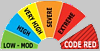 CFA Sugarloaf Area Fire Rating