Internal Icon
scroll

Current Sugarloaf Wind

Wind Speed
Current wind data


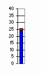
The left wind strength bar is the average wind. The right bar represents gusts. The text at the top of the graph is the wind speed, eg. 9 followed by the wind direction eg. SW, followed by the day of the month and finally the time of recording.
Air Temperature
air temp
Measured - Grey. Apparent (Wind Chill) - Blue.

This data is provided by the BOM automatic weather station at Coldstream at 10 min intervals. Experience shows that it accurately represents the wind on the Reservoir although at Sugarloaf, gusts around the hills can reach twice the average over a 2 hour period. Temperature data has been altitude adjusted. This site is updated by the Club between 6:00 and 22:00 hours only.

It is the individual sailor's responsibility to match his or her skills to weather conditions and to choose to sail or not to sail. It is also the right of the Rostered Duty Manager to close the lake to sailing if he or she considers the conditions beyond the capability of the Rescue Crew or their equippment or for other management reasons. A scale is provided below as a guide only.

Average 0 to 5 Knotswhite0 to 2 Knots is drifitng condtions. It is likely the race course will be shortened
Average 5 to 10 KnotsbeigePleasant sailing
Average 10 to 15 KnotsgreenBoistrous sailing. Inexperienced sailors may have trouble gybing in some parts of the lake. Sailability may be closed.
Average 15 to 20 KnotsblueExperienced sailors may be sailing conservatively to avoid damage in the gusts. Sailability probably closed.
Average >20 KnotsredDamage to most classes of off the beach boats is likely. It is probable the RDM will have closed the lake to sailing.
sugarloaf standard web
scroll